
HIMSTATE DISTRICT REFERENCE
Chamba District, Himachal Pradesh
Ravi valley towns, mountain communities and a living heritage.
Explore Chamba through its geography, history, people, crafts, economy, places and public institutions. Discover the district’s history, communities, languages and landscapes, with context for both everyday life and travel.
ON THIS PAGE
Overview · Key facts · Geography · History · People · Languages · Arts & crafts · Festivals · Food · Places · Economy · Administration · Institutions · Travel · Further reading
Chamba district: beyond the town
Chamba is a district in north-western Himachal Pradesh, with its headquarters in Chamba town. It brings together the Ravi valley, the mountain settlements of Bharmour, the Pangi region in the Chandrabhaga–Chenab valley system, and places such as Dalhousie, Khajjiar, Churah, Salooni and Bhattiyat.
These regions share an administrative identity but differ in landscape, language and local experience. A town visit, a study of the former princely state and a journey into Pangi each reveal a different part of Chamba.
Town, district and former state
Chamba town is the present district headquarters. Chamba district is the modern administrative area. The former Chamba state belongs to the region’s political history. Keeping these meanings distinct makes its geography and history easier to follow.
What gives Chamba its identity?
Its identity brings together temple and museum heritage, regional languages, pastoral traditions, embroidery, leatherwork, fairs and mountain livelihoods. This profile connects those subjects so that Chamba can be understood as a lived-in district as well as a destination.
Chamba at a glance
Chamba town
District headquarters, in the Ravi valley. Its civic and cultural landmarks provide an introduction to the wider district.
6,522 km²
District area recorded in the administration’s Census 2011 demographic profile.
5,19,080 residents
District population in Census 2011. This is a historical census count, not an estimate for 2026.
Census 2011 recorded 4,82,972 rural residents and 36,108 urban residents. The figures underline the importance of looking beyond the headquarters town when studying Chamba’s settlements and everyday life.
Explore Chamba by subject
Geography & rivers
Understand the Ravi and Chandrabhaga–Chenab valley settings.
History
Follow the story from Brahmapura to the princely state and modern district.
People & languages
Explore regional communities, language traditions and changing livelihoods.
Towns & regions
Find the differences between Chamba town, Bharmour, Pangi and other places.
Economy & public life
Understand livelihoods, administration and local institutions.
Geography, rivers and mountain landscapes
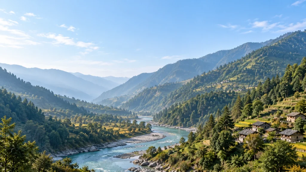
Chamba’s geography is shaped by steep slopes, narrow ravines and marked changes in elevation. Conditions in the lower valleys differ from those in higher mountain areas, influencing cultivation, settlement and the time needed to travel between places.
The Ravi valley
The Ravi is central to Chamba town’s geographical setting and to the district’s hydropower landscape. Following the valley helps connect the location of settlements with river infrastructure and routes through the hills.
Pangi and the Chandrabhaga
Pangi belongs to the Chandrabhaga–Chenab valley system. Chamba district therefore extends across more than one river setting; the whole district cannot be described simply as the valley around Chamba town.
The distinction matters in practice. A journey that appears short on a map may cross difficult terrain or require a longer road approach. Farming conditions also vary: a crop or planting calendar suitable for one elevation may not suit another.
History of Chamba
Chamba’s history reaches beyond the present town. Brahmapura, now Bharmour, was an earlier capital of the ruling dynasty. Sahil Varman is associated with the later shift to the lower Ravi valley, where Chamba town developed as the political centre.
Founding traditions
The account linking the town’s name with Champa, the ruler’s daughter, is part of its founding tradition. The Sui Mata narrative connects a queen’s sacrifice with the town’s water supply. These stories remain significant to local memory and worship; they should be understood as traditions rather than read as independently established accounts of every event.
The princely state and regional powers
Chamba’s rulers interacted with neighbouring hill states and larger powers. Mughal influence reached courtly art and architecture, while Sikh power later affected the hill states. Under British paramountcy, Chamba continued as a princely state. On 15 April 1948, Chamba became part of the formation of Himachal Pradesh.
Reading history through objects
History survives in more than royal names. Copper-plate grants, miniature paintings, carved doors and old photographs preserve evidence of patronage, ownership, artistic practice and changing town life. Bhuri Singh Museum, founded in 1908, brings together collections that help readers connect the written history with material evidence.
The move from an earlier capital to a princely centre and then a modern district provides a starting chronology. Temple histories, individual rulers and the development of Chamba town each deserve closer study within that larger story.
Proposed link — History of Chamba: /history-of-chamba/
People and communities of Chamba
Chamba’s population includes communities with different regional identities, occupations and cultural traditions. Town residents, farming households, artisans and pastoral families all belong to the district’s social history. No single occupation or traditional costume represents everyone.
Gaddi communities and Bharmour
Bharmour has a strong association with Gaddi communities. Farming and the seasonal movement of sheep and goats have been important parts of Gaddi livelihoods. Movement between higher summer pastures and lower winter areas connects community life with the mountain environment.
Proposed link — Gaddi Community of Himachal Pradesh: /gaddi-community-himachal-pradesh/
Pangi and Pangwal identity
Pangi has its own regional identity and Pangwali language tradition within Chamba district. It is also a distinct focus of tribal development administration. Understanding Pangi requires attention to its valley communities rather than treating it as a distant extension of Chamba town.
Continuity and change
Research among Gaddi communities describes changes in farming, food systems and pastoral life. Community identity should therefore not be reduced to an unchanging image of shepherds in traditional dress. Older practices coexist with changing work, education and household choices.
For a district profile, this means looking at people as participants in contemporary life as well as bearers of heritage. Crafts depend on makers, festivals on participating communities, and local knowledge on the people who practise and transmit it.
Proposed link — People and Communities of Chamba: /people-and-communities-of-chamba/
Languages and regional expression
Chamba’s language landscape includes Chambeali, Bharmauri/Gaddi, Churahi and Pangwali. These names help make regional differences visible; the broad label “Pahari” alone does not explain the district’s linguistic diversity.
| Language tradition | Regional context |
|---|---|
| Chambeali | Associated with Chamba and its surrounding cultural region. |
| Bharmauri / Gaddi | Connected with Bharmour and Gaddi communities. |
| Churahi | Associated with the Churah region. |
| Pangwali | Associated with Pangi. |
This is an introductory selection, not a complete inventory of every language spoken in the district. Language, community identity and administrative boundaries do not correspond exactly. A language name also does not imply that every resident of a region speaks it.
Local speech gives context to place names, oral accounts and songs. When recording these traditions, the locality and the speaker’s own identification are as useful as the general district label.
Proposed link — Languages of Chamba District: /languages-of-chamba-district/
Proposed link — Chambeali Language: /chambeali-language/
Arts, crafts and cultural heritage
Chamba’s artistic heritage includes work made for courtly, religious, domestic and everyday settings. Embroidery, paintings, leather footwear and carved objects reflect different materials and skills. Their value lies in the makers’ knowledge as well as the finished objects.
Chamba Rumal
Chamba Rumal is an embroidered textile tradition associated with the patronage of the former rulers. Detailed designs and colour are central to its character. Its use as a marriage gift connects artistic skill with family occasions and social life.
Proposed link — Chamba Rumal: /chamba-rumal/
Chamba Chappal
Handcrafted leather footwear represents a different strand of the district’s craft heritage. Chamba chappals are made in natural leather tones and other colours, bringing skilled work into an everyday usable object.
Proposed link — Chamba Chappal: /chamba-chappal/
Painting, carving and museum collections
Miniature paintings and carved doors in museum collections help reveal how visual art formed part of Chamba’s courtly and built environments. Copper-plate grants and historical objects add another dimension: they show how an art collection can also become a source for studying the former state.
Heritage as a living practice
A useful account of a craft asks who makes it, which materials are used and how skills are learned. This keeps the focus on working traditions as well as older masterpieces. The histories of Chamba Rumal, footwear and painting are related, but each has its own scope.
Explore the wider culture and heritage of Himachal Pradesh →
Proposed link — Chamba Miniature Painting: /chamba-miniature-painting/
Proposed link — Temples of Chamba District: /temples-in-chamba-district/
Fairs, festivals and sacred traditions
Fairs and pilgrimages bring together worship, performance, public gathering and local memory. Chamba town’s Minjar Mela and the Manimahesh pilgrimage belong to different settings and should not be treated as interchangeable tourism events.
Minjar Mela
Minjar is associated with a silk tassel symbolising paddy and maize shoots. The fair brings processions, music and cultural programmes into Chamba’s public life, with the Chowgan playing an important role. Its river offering connects the celebration with the Ravi.
Proposed link — Minjar Mela: /minjar-mela-chamba/
Manimahesh pilgrimage
Manimahesh is a pilgrimage associated with Shiva and a mountain lake in the Bharmour region. Worship and the journey through the mountains are both central to its meaning. The lake journey involves different preparation from a visit to Bharmour town.
Proposed link — Manimahesh Yatra: /manimahesh-yatra/
Sui Mata and local memory
Sui Mata worship preserves the tradition of a queen’s sacrifice for Chamba’s water supply. The associated observance gives the story a place in the town’s cultural life. Its significance is best explained through belief, remembrance and community participation.
Music and public performance
Processions and performances are part of Minjar’s atmosphere. Kumjari-Malhar is associated with its musical tradition, alongside the participation of local performers and community groups. Festival dates and arrangements vary by year; a cultural overview is separate from an event schedule.
Proposed link — Sui Mata Temple and Tradition: /sui-mata-temple-chamba/
Proposed link — Fairs and Festivals of Chamba: /fairs-festivals-chamba/
Food and local cooking traditions
Food offers another way to understand Chamba’s regional culture. Everyday meals, festive cooking and household recipes do not all follow one district-wide menu. Chambyali dham is a feast associated with special occasions, bringing several dishes together rather than referring to a single preparation.
Chambyali madra
A kidney-bean preparation using curd, ghee and spices, associated with Chambyali cooking. It is one of the recognisable dishes found in accounts of the region’s feast traditions.
Chukh
A chilli-based accompaniment made with ingredients such as dried red chillies and mustard oil. It introduces a different flavour and serving role from the dishes of a full meal.
The feast and the household
Rice, pulses, breads and regional preparations appear in accounts of local food. A ceremonial meal should not be assumed to represent what every household eats daily.
Proposed link — Chambyali Dham: /chambyali-dham/
Proposed link — Chamba Chukh: /chamba-chukh/
Proposed link — Food of Chamba: /food-of-chamba/
Towns, valleys and places in Chamba
Chamba’s places are best read as a set of different local settings. The following profiles introduce their character; they are not intended as a single-day circuit.
Chamba town
The district headquarters combines civic life with a historic centre. The Chowgan offers a public gathering space; the Lakshmi Narayan temple complex and Bhuri Singh Museum provide introductions to religious and artistic heritage. The town is a starting point for the district, rather than a substitute for it.
Proposed link — Chamba Town: /chamba-town/
Proposed link — Chamba Chowgan: /chamba-chowgan/
Proposed link — Lakshmi Narayan Temple, Chamba: /lakshmi-narayan-temple-chamba/
Proposed link — Bhuri Singh Museum: /bhuri-singh-museum-chamba/
Dalhousie
Dalhousie is a hill town within Chamba district, with colonial-era architecture and a wooded setting. A visit centred on its streets and surroundings differs from a heritage-focused visit to Chamba town. Both belong to the same district, but have distinct identities.
Proposed link — Dalhousie: /dalhousie/
Khajjiar
Khajjiar is recognised for its open meadow enclosed by pine and deodar. It offers a landscape-focused contrast to nearby towns. The meadow, surrounding forest and local sacred associations are better understood together than through a promotional nickname alone.
Proposed link — Khajjiar: /khajjiar/
Bharmour
Bharmour, historically Brahmapura, connects the district’s earlier political centre with its living religious landscape. The Chaurasi temple complex is a central place of interest. Bharmour also provides context for Gaddi communities and the pilgrimage towards Manimahesh.
Proposed link — Bharmour: /bharmour/
Proposed link — Chaurasi Temple Complex: /chaurasi-temple-bharmour/
Pangi
Pangi brings a distinct Chandrabhaga–Chenab valley setting into the Chamba district profile. Its language traditions and mountain communities deserve attention in their own right. Killar is the centre named for Pangi’s Integrated Tribal Development Project.
Proposed link — Pangi Valley: /pangi-valley/
Proposed link — Killar: /killar-pangi/
Churah, Salooni and Bhattiyat
These regional names widen the view beyond the best-known visitor destinations. Churah and Salooni are listed as subdivisions; Chowari is another subdivision name used in the current administrative table. Regional identity and an official administrative label should not automatically be treated as the same thing.
Proposed link — Churah Valley: /churah-valley/
Proposed link — Salooni: /salooni/
Proposed link — Bhattiyat: /bhattiyat/
Chamera reservoir
The reservoir is part of the hydropower landscape on the Ravi. Water storage and generation infrastructure distinguish it from a natural lake. It connects a discussion of scenery with the use of the district’s rivers for electricity generation.
Proposed link — Chamera Lake and Reservoir: /chamera-lake/
Economy, livelihoods and development
Chamba’s livelihoods connect land, skills, public services and visitors. Farming, pastoral activity, crafts, accommodation, transport and hydropower each explain a different part of the local economy. The balance varies between towns and mountain regions.
Agriculture and horticulture
Elevation and climate affect what can be grown. Agricultural work in the district includes field crops, fruit, vegetables and allied activities. KVK Chamba’s demonstrations cover fruit crops, beekeeping and mushroom cultivation, reflecting a range of farming possibilities rather than a single crop identity.
Pastoral livelihoods
Seasonal sheep and goat movement is an important part of Gaddi pastoral history. It connects grazing areas across elevations with household work and farming. It is one strand of the economy, not a description of every Gaddi family’s present occupation.
Crafts and visitor services
Embroidery and leatherwork turn skilled knowledge into products. Visits to heritage places, towns and pilgrimage areas also connect accommodation, food and transport with local livelihoods. These connections help explain why culture and the economy should be read together.
Hydropower and the Ravi
Chamera-I is an NHPC hydropower project on the Ravi, commissioned in 1994. Its reservoir and generating infrastructure are part of the district’s economic landscape. The size of a power station alone does not show how income or employment is distributed locally.
Read the Himachal Pradesh economy overview →
Proposed link — Agriculture and Horticulture in Chamba: /agriculture-horticulture-chamba/
Proposed link — Hydropower Projects in Chamba: /hydropower-projects-chamba/
Administration and political representation
Chamba’s administrative listing records 7 subdivisions, 9 tehsils and 5 sub-tehsils, checked on 8 September 2026. These units organise district administration and should be distinguished from the older territories mentioned in historical accounts.
| Subdivision | Tehsils | Sub-tehsils |
|---|---|---|
| Chamba | Chamba | Dharwala, Pukhri |
| Chowari | Chowari, Sihunta | Kakira |
| Churah | Churah | — |
| Dalhousie | Dalhousie | — |
| Bharmour | Bharmour, Holi | — |
| Pangi | Pangi | — |
| Salooni | Salooni | Bhalei, Telka |
Assembly and parliamentary representation
The district’s listed Assembly constituencies are Churah, Bharmour, Chamba, Dalhousie and Bhattiyat. Bharmour falls within the Mandi parliamentary constituency; the other four fall within Kangra. These arrangements were checked on 8 September 2026.
Electoral constituencies organise political representation, while subdivisions and tehsils organise administration. Their names and boundaries should not be assumed to match. This distinction helps when reading election information or locating an administrative jurisdiction.
Explore HimState’s government schemes and policies →
Proposed link — Assembly Constituencies of Chamba: /chamba-assembly-constituencies/
Education, healthcare and public institutions
Public institutions connect the district’s settlements with education, healthcare, training and administration. Their role is part of a district profile even when a reader is not planning a visit.
Medical education and healthcare
Pandit Jawahar Lal Nehru Government Medical College and Hospital is a named public institution in Chamba. It connects medical education with healthcare. Current clinical services and appointment arrangements need to be checked with the institution before a visit.
Agricultural learning at Saru
Krishi Vigyan Kendra, Chamba, at Saru is part of Dr Y.S. Parmar University of Horticulture and Forestry. Its work includes farmer training, field demonstrations, farm advice and soil analysis, connecting agricultural research with local practice.
Museums and cultural learning
Bhuri Singh Museum provides a setting for studying art and historical objects. Its collections connect education with the district’s cultural record, complementing the experience of seeing buildings and worship spaces in the town.
Proposed link — GMC Chamba: /government-medical-college-chamba/
Proposed link — KVK Chamba: /krishi-vigyan-kendra-chamba/
Understanding Chamba as a visitor
Plan a visit around the part of Chamba you want to understand. Town heritage, Dalhousie–Khajjiar, Bharmour and Pangi require different approaches. The district’s size and terrain make a long list of places a poor substitute for a workable route.
Choose a geographical focus
Group nearby places and allow time for their individual character. A town-and-museum visit differs from a meadow outing or a mountain pilgrimage. Add another valley only after considering the actual journey.
Allow time for road travel
Pathankot is an important rail gateway for onward road travel. Treat the mountain leg as a separate part of the trip, with time for stops and delays. Confirm current access close to departure, especially for higher routes.
Respect worship spaces and local customs, ask before photographing people or rituals, and keep waste out of rivers, meadows and trails. A general district profile does not establish that a road, pilgrimage route or activity is currently operating.
Continue to HimState’s Himachal Pradesh tourism hub →
Proposed link — How to Reach Chamba: /how-to-reach-chamba/
Proposed link — Chamba Travel Itinerary: /chamba-travel-itinerary/
Continue reading on HimState
Geography of Chamba
Explore the district’s physical geography through HimState’s Hindi reference entry.
Chamba articles
Browse published entries about the district and its related subjects.
Culture and heritage
Connect Chamba’s traditions with the wider regional diversity of Himachal Pradesh.
Questions about Chamba
Is Chamba a town or a district?
Both. Chamba town is the district headquarters. The district also contains other towns, valleys and administrative areas, including Dalhousie, Bharmour and Pangi.
What is Chamba known for?
Chamba is associated with temple and museum heritage, Chamba Rumal, handcrafted leather footwear, Minjar Mela and mountain regions with distinct local traditions.
Was Bharmour an earlier capital?
Yes. Brahmapura, now Bharmour, was an earlier capital before the political centre shifted to Chamba town.
Which language traditions are associated with Chamba?
They include Chambeali, Bharmauri/Gaddi, Churahi and Pangwali. The district is linguistically diverse; these names are an introductory selection.
Is Pangi part of the Ravi valley?
Pangi belongs to the Chandrabhaga–Chenab valley system. Chamba district includes more than one river-valley setting.
What is the population of Chamba district?
Census 2011 recorded 5,19,080 residents. This historical count should not be presented as a current population estimate.
Can all the main places be covered in one day?
The district overview is not a one-day itinerary. Choose a locality or circuit, then plan travel according to distance, terrain and current access.
Explore the wider Himachal Pradesh
Place Chamba’s local story within the State’s geography, history, culture and public life.
Himachal Pradesh Encyclopedia → · Tourism and travel →
Last researched: 8 September 2026. Population figures refer to Census 2011; administrative information is dated separately.